Saharan dust lingers over South Florida on Monday, with another plume on the way.
Besides causing allergies to act up, the dust should lower the region’s rain chances for the first day of school in Miami-Dade County public schools.
Saharan dust reduces South Florida’s rain chances to below normal but doesn’t completely stop it, according to the National Weather Service. And yes, scattered thunderstorms will still be possible, particularly in the afternoon and evening.
By the afternoon, it will also be “hot, hazy and humid,” said WSVN Meteorologist Vivian Gonzalez.
“Highs in the 90’s and feeling like the triple digits. Pack an extra bottle or two of water before stepping outside the door,” Gonzalez wrote on Twitter.
Monday’s forecast is calling for a 20% of rain in Miami-Dade and Monroe counties and a 30% chance of rain in Broward County. One or two strong storms will be possible in South Florida.
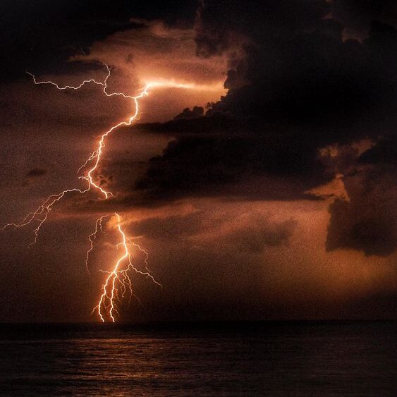
“The primary threat is lightning, gusty winds, small hail, and brief heavy rainfall,” according to the weather service’s hazardous weather outlook. The small hail will be possible across the Lake Okeechobee region during the strongest storms Monday afternoon.
Forecasters expect another plume of Saharan dust to arrive into South Florida later Monday or early Tuesday, so hazy skies will be possible Monday evening through Tuesday. That could cut visibility on the road, so drive carefully.
On Wednesday, the dust shouldn’t affect weather patterns. Expect 40% of rain Wednesday and 50% chance of rain Thursday through Friday in Miami-Dade, according to the weather service. In Broward, rain chance will range from 30% to 50%. In the Keys, the chance of rain this week ranges between 20 to 30%.
The hazardous weather outlook expects isolated to scattered thunderstorms, rip currents along the Atlantic coast and temperatures that feel like they’re in the lower to mid-100s for the rest of the week.
